Drone Fleet Management Software
for Public Safety

Used by law enforcement, fire departments, and emergency response teams worldwide to manage safe, compliant, mission-ready drone operations.

DJI M300 drone
0
Active Pilots
0
Flights Logged
0
Public Safety Users
0
Countries

Trusted by Agencies Worldwide

Explore the growing network of public safety agencies using AirData to manage their drone programs.

Bothell PD
LAPD
Salt Lake City Police
Kansas City Sheriff
Chico PD
LA Port Police
Anne Arundel PD
Palm Springs PD
Clovis PD
Chula Vista PD
Sacramento PD
Huntsville PD
Las Vegas Metro PD
Ohio DOT
Linden PD
South Fire
Beckley Fire
Richardson Fire
Bothell PD
LAPD
Salt Lake City Police
Kansas City Sheriff
Chico PD
LA Port Police
Anne Arundel PD
Palm Springs PD
Clovis PD
Chula Vista PD
Sacramento PD
Huntsville PD
Las Vegas Metro PD
Ohio DOT
Linden PD
South Fire
Beckley Fire
Richardson Fire
"Implementing AirData's Public Portal into our UAS program has revolutionized the way we share our drone operations with the community..."
Steven Oscar // Las Vegas Metro PD
"In critical incidents, I can share the drone's live feed with our whole team in seconds...shared awareness means everyone is on the same page."
Nic Fox // Sacramento PD
"We've used AirData for years, and live streaming through the platform has been key to our success... a game changer for situational awareness."
Chad Tillman // Huntsville PD

Platform Features

AirData provides the operational backbone for modern public safety drone programs, bringing fleet oversight, compliance, and mission visibility into one unified platform.

Secure Live Streaming
SECURE LIVE STREAMING
  • Stream any flight to incident commanders, command centers, or across jurisdictions
  • Sub-one-second latency over standard Wi-Fi or cellular
  • No proprietary hardware required
  • PIN-protected viewing for approved external stakeholders
Learn More ↓
Fleet Readiness
FLEET READINESS & COMPLIANCE
  • Automate compliance documentation
  • Track equipment health and battery cycles
  • Log service history across your fleet
  • Pre- and post-flight checklists support multi-pilot compliance
Learn More ↓
Community Transparency
COMMUNITY TRANSPARENCY
  • Public Portal displays flight paths for community visibility
  • Search deployments by location or date
  • Configurable public-facing experience
  • Pilot-controlled confidentiality settings for sensitive missions
Learn More ↓
Data Sync
Flight Analysis
Maintenance
Asset Management
Mission Planning
Reporting
Alerts
Sharing
LAANC
Certification Management
178 Drones & Flight Apps Supported — and growing

Built for Every
Safety Mission

From DFR deployments to wildfire response, AirData works the way your program works, logging everything automatically, keeping your fleet mission-ready, and giving command the visibility they need in real time.

Drone as First Responder
  • Automatic flight logging at every dock deployment
  • Real-time battery health and airframe cycle tracking
  • Compliance records generated without pilot admin work
  • Fleet readiness dashboards across your dock network
View Screenshot
Fleet Readiness Dashboard
AirData Platform Screenshot
Tactical & Critical Incident Response
  • Instant live aerial streaming over Wi-Fi, cellular, or hotspot
  • Share secure links or QR codes with no IT setup
  • Monitor multiple drones including tactical platforms like DJI Avata
  • Every flight auto-documented for after-action review
View Screenshot
Live Streaming Multiview Player
Search & Rescue
  • Pre-flight grid planning tools
  • Live stream to remote decision-makers
  • Team-wide battery monitoring to prevent interruptions
  • Flight replay to confirm coverage and find gaps
View Screenshot
Flight Review
AirData Platform Screenshot
Fire Response & Disaster Assessment
  • Centralized fleet readiness across all stations
  • Track airframe hours, battery cycles, and maintenance
  • Shared-aircraft accountability across crews
  • Auto-log thermal, fire response, and disaster missions
View Screenshot
Maintenance Tracking
AirData Platform Screenshot
Traffic Collision & Scene Documentation
  • Live overhead streaming to off-site investigators
  • Auto-capture GPS, pilot identity, and mission data
  • Generate reports for legal, public records, or insurance in minutes
  • Shareable flight records for oversight and accountability
View Screenshot
Custom Reports & Documentation
AirData Platform Screenshot
Works With Your Existing Fleet

AirData supports more drones and flight apps than any other platform. It works alongside DJI Pilot 2, Autel Enterprise, Litchi, and others so your pilots don't change a thing about how they fly. Your data stays yours, regardless of which hardware or app combination your fleet uses.

View Supported Aircraft & Apps
Drone and police car in the field
LIVE
Multiview Command Feed
AirData Live Streaming Multiview

Low Latency
Live Streaming

AirData Live Streaming was built in close collaboration with public safety agencies to be fast, reliable, and simple to deploy, even over mobile hotspots in the field. It streams whatever is on the pilot's phone, tablet, or smart controller screen, regardless of which flight app they're using.

Available as an Enterprise Add-On
One-Second Latency over Wi-Fi or Cellular
Immediate visibility when it matters most. No special infrastructure required.
Dock Support for DFR Programs
AirData supports live streaming from dock-based DFR flights, giving command real-time aerial visibility for fully automated deployments.
Multiview Player
Multiple live feeds populate automatically in one dashboard as pilots go live. No manual setup for command staff.
Real-Time Text & Email Alerts
Get notified the moment a stream goes live, a battery hits a threshold, or a maintenance alert is triggered, keeping supervisors in the loop without being in the field.
Flexible, Secure Sharing
Unique links, QR codes, and PIN-protected access for controlled cross-agency viewing.
Start Your Free Trial

Built-in Compliance

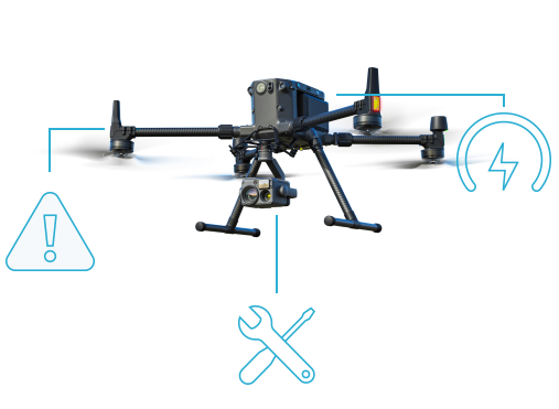
Public safety drone programs face real regulatory and legal risk. AirData automatically captures required flight data, eliminating manual logs and protecting your program. Teams reclaim hours each month that would otherwise go to spreadsheets and last-minute reporting.

Automated Flight Logs
Every flight is automatically recorded with timestamp, GPS coordinates, pilot identity, aircraft serial number, and mission type. No manual entry required.
Customizable Reports
Pull clean, formatted reports in seconds to respond to public records requests without pulling anyone off mission or digging through spreadsheets.
Custom Report Builder
Filter by date range, pilot, drone, mission type, or incident to generate the exact report you need for leadership, oversight committees, or legal counsel.
Waiver & Registration Tracking
Stay ahead of airspace waivers, authorizations, and aircraft registration expirations with automated alerts before they lapse.
Start Your Free Trial
Flight Report
AirData Flight Report
Reports
AirData Reports Dashboard
Customizable Reports
Auto-Logged
airdata.com/u/cvpd
AirData Public Portal
airdata.com/u/cvpd
AirData Public Portal Map
Live Public Portal
View Chula Vista PD's Public Portal ↗

Transparency
That Protects
Your Program

Drone programs in law enforcement face growing scrutiny. AirData's Public Portal helps agencies build trust with a configurable, public-facing site where residents can search flights by address or date.

Available as an Enterprise Add-On
Customizable Data Delay
Withhold flight data for a set time period before publication, providing a blanket layer of operational security.
Pilot-Level Confidentiality Controls
Pilots on sensitive missions can keep individual flights confidential by completing a quick post-flight checklist directly from the AirData mobile app.
Flight Tags
Granular controls that give pilots precise authority over how their data is shared, mission by mission.
Automatic Filtering
Shared data is filtered according to each organization's parameters, protecting confidentiality without manual review.

Resources

Take Control of Your
Drone Operations

Manage your fleet, document every mission, and give leadership real-time operational insight with a platform trusted by public safety agencies worldwide.

Common Questions

A DFR program deploys prepositioned drones to emergency scenes in minutes, often before ground units arrive. Success starts with FAA authorization, the right drone technology, and trained pilots ready to respond.
  • Obtain FAA BVLOS waiver and COA
  • Select NDAA-compliant drones and fleet management software
  • Position drone launch stations in high-call-volume areas
  • Assign dedicated, trained pilots
  • Integrate with CAD and 911 dispatch
  • Track every flight for compliance and reporting
Law enforcement agencies commonly rely on drones from DJI, Autel, Skydio, and Parrot, including models like the DJI Matrice 300/350, M30T, Autel EVO Max 4T, Skydio X2 and X10, and the Parrot Anafi USA Gov. AirData supports all of these out of the box, automatically syncing flight logs and managing fleet data across every aircraft. AirData is also integrated with BRINC, extending that same fleet visibility to indoor and tactical drone operations.
Training requirements vary by country, but most law enforcement drone pilots must hold a government-issued remote pilot certification, such as the FAA Part 107 in the U.S. or equivalent licenses in Europe and Australia. Many agencies also require mission-specific and ongoing recurrency training for tactical operations, search and rescue, and Drone as First Responder (DFR) programs.
The cost of a police drone program varies based on scale and deployment model, ranging from $10,000 for a basic setup to $300,000+ for a full Drone as First Responder (DFR) station. Costs increase with advanced infrastructure, staffing, and ongoing operations.
  • Hardware: $10K–$65K+ (drone, sensors, optics)
  • DFR docking stations: $150K–$300K per site
  • Software: AirData offers custom pricing based on fleet size and program needs
  • Training: $150–$700+ per pilot (FAA Part 107 + advanced training)
  • Maintenance: $5K–$15K+ annually (batteries, repairs, warranties)
Law enforcement agencies can access drone funding through federal programs like FEMA's Homeland Security Grant Program and, following the DRONE Act of 2025, the DOJ's Edward Byrne JAG and COPS grants, which now permit drone purchases for the first time. State-level grants, highway safety funds, and private foundations offer additional options, with availability varying by jurisdiction.