AirData Helps Megilot Rescue Drone Team Save Lives - Use Case
Contributed post by Ariel Zentner, head of Megilot Rescue Drone Team. This incredible organization compiled of only volunteers utilizes drones as a force multiplier for their team. We thank Ariel for this write-up on using drones and AirData for Search and Rescue!
AIRDATA UAV helps save lives
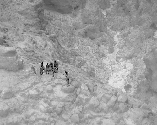
The Megilot Rescue team operates in the North of the Judean Desert. Our goal is to save lives and assist travelers and hikers in need of help, either due to injury, medical conditions or simply getting lost (which can easily lead to the other two).
The whole unit from top to bottom is volunteer-based, we get called out to an average of 100 rescues a year. The unit currently consists of approximately 90 volunteers, who mostly live in or near the North Judean Desert.
About five years ago we discovered the extraordinary value of drones as a game-changing tool in the rescue business. We use drones for a variety of missions: searching for people, command and control of our teams, finding and planning complex routes, a visual aid when rappelling in complex terrain, and also for documenting and sharing our experiences.
We have built a professional drone team, which helps us achieve all the above goals. Our team consists of approximately ten pilots, half of whom are officially certified and half who have yet to pass official certification, and about 7 active drones. Over time we have developed quite an expertise at flying in tight conditions, very low and close to the ground, and dealing with frequent disconnection and interruptions due to steep descents and ascents. We train regularly, and have successfully used drones in numerous rescue missions, some of which were quickly handled thanks to the drones. A search mission which in the past took us hours of footwork, can sometimes be solved in minutes if we have a drone at the right spot.

Due to our volunteer-based structure, most drones aren’t personal (i.e. assigned to a specific pilot), rather we all share them according to need and availability. Each mission could have different pilots flying different drones. We must have good documentation and control over our fleet of drones and pilots, or else there will be a big mess. Requesting each volunteering pilot to manually fill out a lengthy form with all the flight details, post-flight, was too much to ask from people and led to it just not happening. We felt we needed a professional system to keep track of all the information.
Our research led us to AIRDATA UAV which we found to be a good, simple, user-friendly, yet powerful way to keep track of all the various pilots and equipment. After using it for a few years we have learned to trust it and rely on it to the extent that we honestly don’t know how we can operate without it.
All our logs are synchronized automatically to AirData without any user intervention, so all our pilots need to do is sync up their tablet device (usually via the DJI sync).
We group our flight by subject an actual rescue mission, a team training mission, or just our pilots performing personal practice. This helps us keep things tidy and easy to access and reference. We tag our flights with tags such as rescue/training/safety issues/etc. So that we can easily get a report of only the group of flights we’re interested in.
The grouping also really helps us visualize a mission and see what ground was covered during a SAR mission, and which still remains unsearched. Due to our terrain's great variance in height, and narrow ravines, it’s crucial that the pilot stands in the correct position in order to achieve the required coverage for the mission. We use these diagrams from previous flights as a reference to what coverage is possible from a specific spot, that way when a real rescue comes in we can choose our piloting positions cleverly, in order to best suit the mission at hand.

We regularly check the device maintenance and battery tabs, to see how our equipment is performing and if anything needs to be taken into notice.
Since we fly in challenging terrain, we stretch the drone's capability to their limits, and commonly encounter signal loss and other unwanted behaviour. During flight case investigations we often go back and look at the informative General->Notification tab, and HD Flight Player. We analyse which unwanted events occurred during the flight and try to understand what may have caused them, by cross-checking the pilot’s location, drone position and stick inputs. With this information we learn how to avoid such cases in the future, and how to get better at what we do.
All in all, we thank AIRDATA UAV for such a great product, and for helping and supporting us whenever we need. We find them professional, courteous, and willing to help, and really enjoy using their product.
A short video showing the exciting moment when our rescue team reached the people in distress: https://youtu.be/vKPF6peyUl8
The people were discovered using one of our drones, and this was a pitch-black night.
Thank you AirData!
Megilot Search and Rescue - Drone Team